Industrial Sites and Construction Progress Monitoring
Monitor progress efficiently, make timely decisions, and cut costs with easy to use online platform providing unique insights from satellite data and AI
What can you do with SpaceKnow Guardian?
Regular and cost-effective advanced reporting
Construction progress
measurement
Identifying potential issues for timely decision-making
Reduction of the risk of delays, and cost overruns
Security monitoring in pre-defined perimeter
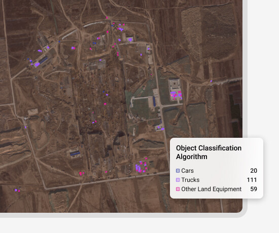
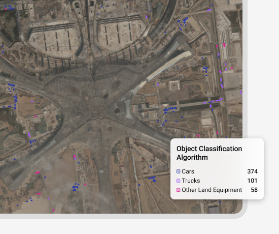
Production estimates way ahead of officially announced numbers
How it works?

Tell us about your locations and we assess what can be done

We set up everything for you

Access your locations anytime and keep getting fresh insights over the next 12 months
Industrial Sites Monitoring
Satellite data empowers decision-makers with unprecedented insights about virtually any location in the world. Whether the interest is to estimate production of a factory way ahead of officially announced numbers, understand activity at a logistics hub, beware of signs of encroachment to secured land, or keep track of the installed capacity of a power plant, satellite data and SpaceKnow AI are here to help.
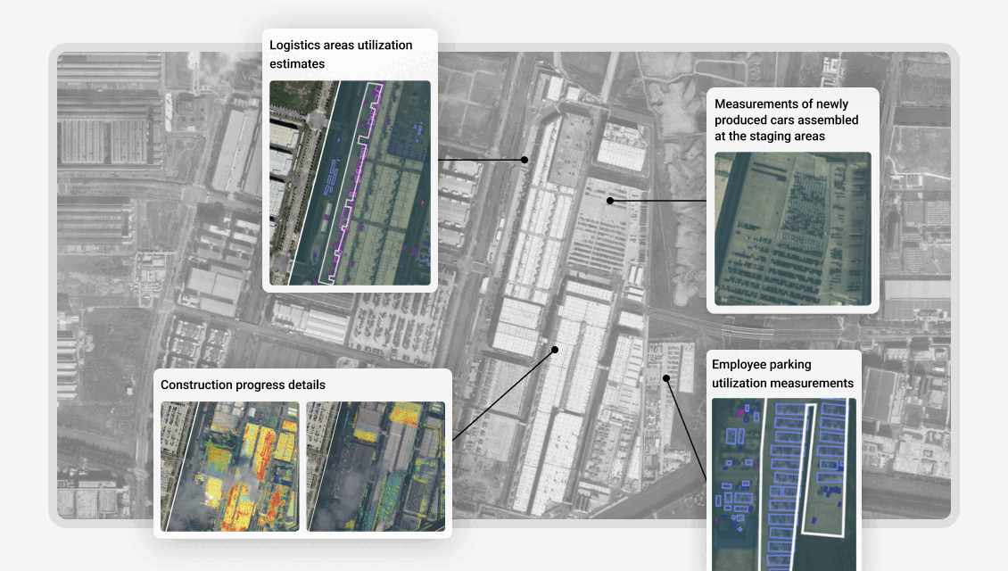
Construction Progress Monitoring
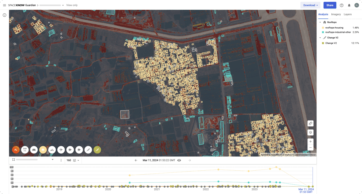
Enterprises typically oversee expansive construction projects across multiple locations and periodic reports are essential for company management and project stakeholders. Satellite imagery analytics revolutionizes the traditional methods of data collection by leveraging satellite imagery and geospatial data (for instance, cellular phone data). This advanced practice enables systematic observation, analysis, and management of construction sites. With near-real-time and regular satellite data, construction progress can be efficiently monitored, facilitating timely decision-making and reducing costs.
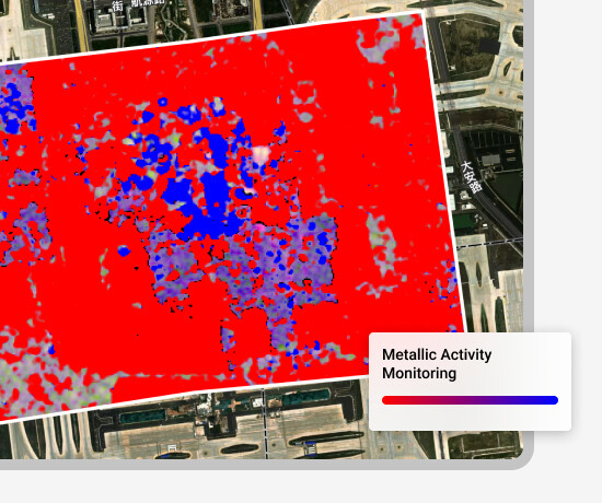
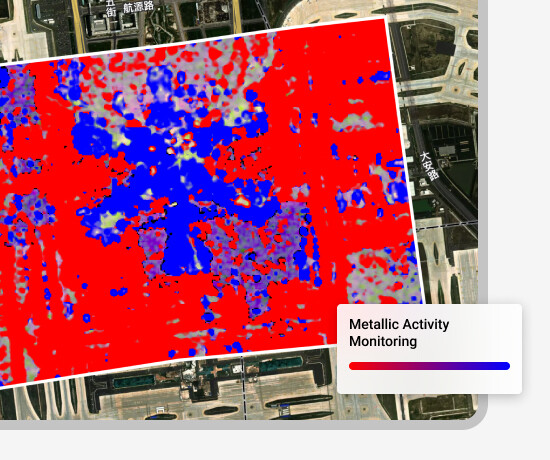
High Resolution Imagery for detailed construction progress monitoring
Low Resolution Imagery for general construction monitoring
Thanks to the utilization of low-resolution radar imagery, we are able to monitor construction progress in any weather, because radar images have the capacity to penetrate and collect data even on days when there are thick clouds.
High-Level Reporting for all Stakeholders
All analytical outputs and important information are consolidated into a single report tailored to your preferred format. Would you like it as a document or a presentation?
Just let us know.
Get started with
SpaceKnow Guardian
Leverage the power of AI and satellite data, and monitor anywhere, anytime, and at scale