Satellite intelligence plays an integral part in monitoring forests. Academics and businesses are advancing various satellite analytics solutions that help in forestry management, detection of illegal logging, tracking carbon credits, or evaluating environmental changes in specific regions. All these solutions traditionally rely on optical data which can, however, be unsuitable for many cases and need to be complemented or replaced with SAR (Synthetic Aperture Radar) data.
Optical data is not always a viable or sufficient solution, especially in regions with high cloud cover, such as tropical forests. This poses a serious problem given the key role of tropical forests in the mitigation of climate change (it is estimated that tropical forests stock more than half of global forest carbon [1]). Additionally, optical data can be costly for extensive projects requiring a high level of detail. For these reasons, there is an increasing demand for SAR-based solutions [2].
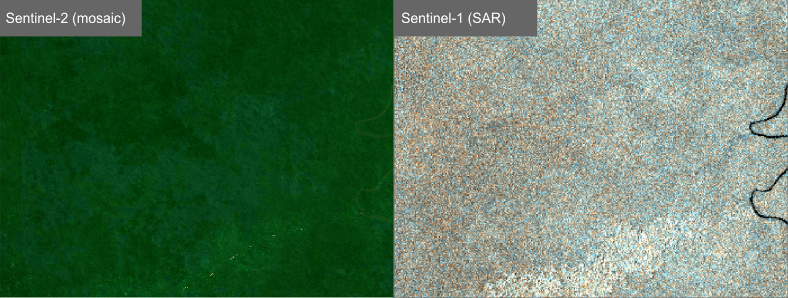
Unlike optical satellite imagery, SAR can penetrate clouds, making it an ideal tool for monitoring forested areas in cloudy regions. Besides, ever since the introduction of ESA’s Sentinel-1, SAR can be freely available and accessible for any region in the world. The shortcomings are its lack of historical data and the difficulties in interpreting the data.
Monitoring forests with SAR is still in its early stages and is awaiting launches of new breaking sensors in the upcoming years (ESA’s Biomass P-band SAR mission [3], NASA’s NISAR L-band SAR mission [4] or JAXA’s ALOS-4 satellite [5]). In the meantime, SpaceKnow is paving a path through currently available data.
Recently, SpaceKnow has developed a first-generation SAR-based forest surveillance solution for Forest.io, a project to provide carbon offsets in a transparent way. Currently, it is developing a second-generation of the solution. The goal is to track (on a frequent basis) forests in Central Africa that underlie the offered carbon credits.
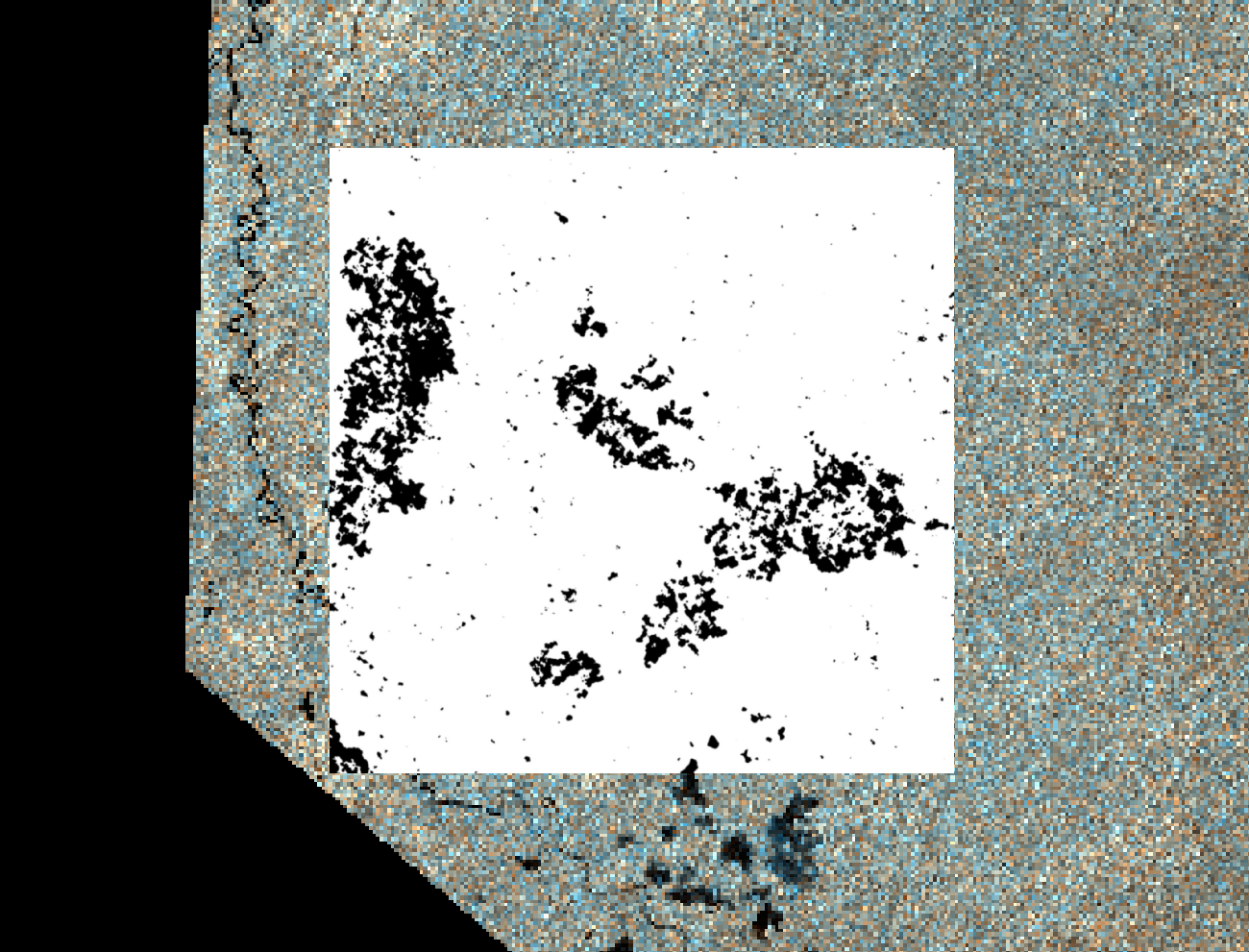
SpaceKnow works intensely with SAR data in a variety of projects. Tracking deforestation with SAR proved to be, however, extraordinarily challenging. It is a task that is highly region-specific. Besides, the backscattering from forests is sensitive to even small disruptions like rain which bring additional difficulties for processing and interpreting the data.
“If it were easy, we wouldn’t be doing it. We are determined to do things that matter, no matter how challenging they may be at first. We have certainly made progress, and are further intensifying our efforts in forest and carbon monitoring,” SpaceKnow’s CCO Anu Murgai notes.
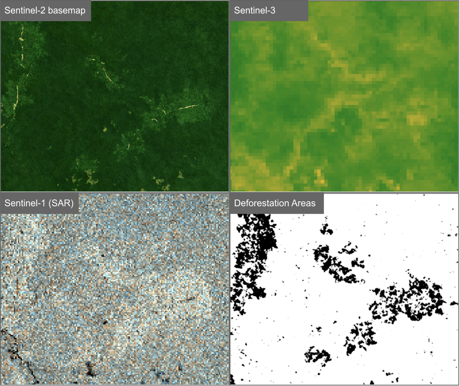
While the first-generation solution leverages thresholding of a variety of statistical representations of the backscattering and its change throughout time [6], the second-generation solution is going to utilize Deep Neural Networks more intensely.
Finally, the SAR-based insights can be complemented with information from the (more straightforward but weather-dependent) optical data, together creating a powerful solution for keeping track of forests even in cloudy tropical regions.
Are you interested in learning more about SAR- and optical- based solutions for forest surveillance? Contact us today to speak to one of our experts.
Interested in our experience in deforestation monitoring using optical data? See these use cases.