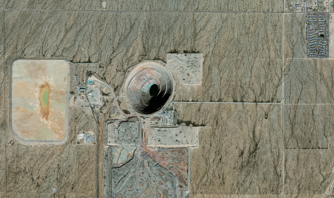
We live in a data-driven world. Organizations of all kinds are seeking new data sources, as well as new ways to use their existing data to innovate and stay ahead. Satellite data analytics, as a vehicle for gaining business intelligence, has huge potential and is underutilized. In this series of blogs, we will approach satellite data from a user’s perspective and offer practical steps to take advantage of it.
At SpaceKnow, our mission is to democratize satellite data analytics, so that any organization, no matter how big or small, can leverage this technology. Earth Observation (EO) technologies allow us to map, measure and monitor Earth’s terrain, resources, activity, events and ecosystems on a high-frequency, near-real time basis. With our provider-agnostic models and algorithms, we are able to fuse data from a wide variety of imagery types and providers, enabling us to provide creative and comprehensive solutions to our customers. This data is being used to analyze urbanization, fight forest fires, measure the impact of climate change, monitor infrastructure development, and much more. As the number of satellites in space increases, imagery is cheaper and easier to access than ever before. Translating these images into actionable intelligence, however, requires sophisticated technical skills and infrastructure. We have built the tools and solutions that allow our customers to gain from this new technology.
How can the insights we extract from satellite data add value to your business? We will let you in on a little secret: it’s not as complicated as it sounds. Our goal is to arm you with the knowledge you need to evaluate how satellite data may provide insight into your specific use case.
Define the problem and list the metrics that would help you solve it
What are you trying to accomplish? What is the problem you want to solve and how do you measure success? Be as specific as you can be.
For example, if you want to monitor the parking lot of your warehouses for optimal flow, you could either:
- Generally observe whether the parking lot is more or less empty than the last observation
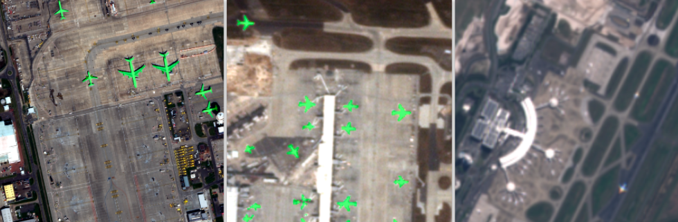
- Count the number of vehicles in the parking lot and look at the difference from the last observation
These two options have different levels of accuracy, cost and development time. Thinking through what you need for business decisions in specific detail will help you guide the conversation around trade-offs with your analytics provider.
Here are some of the factors to consider before getting on the phone with a satellite imagery analytics provider:
- Frequency: How often do you need a data point?
- Image Resolution: What do you need to observe on the ground? What’s the size of it?
- Period of time: What time range do you want the analysis to cover? Is the analysis backward-looking or forward-looking in time? Will you need imagery on specific days at specific times, or are you willing to use what’s already available (or might become available in the future)?
- Area(s) of Interest (AOI): Where in the world do you want to run this analysis? The more specific the better.
- Weather and cloud cover: Do you need the analysis in an area that typically has a lot of clouds? In this case, some types of imagery may not be useful to you.
- Level of accuracy: Are you looking for exact numbers or general trends?
- Type(s) of analysis: How do I want to see the end product? (visuals, data, coordinates, etc.)
- Delivery: How soon do you need it and in what form should it be delivered?

Working with a satellite data analytics provider
For every problem a client wants to solve, a good analytics provider can come up with several options. Their proposal should outline choices (and pricing) for every step of the solution. Transparency should be a key feature of the proposal. Here are some of the elements you should expect.
- Imagery: What types of images can the provider use to solve your problem? At SpaceKnow, we have the flexibility to connect to and work with a variety of satellite imagery providers. When we are asked to provide a proposal, we begin with an ‘availability report’. This tells us (looking back) the image options available to us for analysis. Some areas are in great demand and therefore archived images are easy to procure. In cases where the client wants a forward-looking analysis in a low demand area, we usually need to ‘task’ a satellite, which costs more. For most proposals, we like to offer the client multiple options where we clearly point out the trade-offs between cost, timeliness, and accuracy.
- The solution: Analytics providers may be reluctant to give you details about the exact technology and algorithms they will be using. However, they should tell you:
- Have they provided this solution to a client before? If not, how much of the solution requires customization and development? Does the price reflect that customization? How much time will it take?
- Are they using external data sources for the solution (other than imagery)?
- What’s the level of accuracy they can provide you relative to your ask? Can they quantify this (at least in a range)? Can they give you an example of what the final output would look like?
- If the provider claims to achieve certain values of performance metrics (accuracy, precision, and recall), make sure they clearly communicate what the dataset was benchmarked on, and the quality of the imagery used (whether images with cloud cover, environmental effects, and/or invalid pixels were tested). You should know how well the algorithmic solution works on unseen images in your area of interest, because if they are “cherry-picking”, the results can be really misleading.
- For a commoditized solution, ask for a demonstration or a case study. Most analytics providers can give you some limited examples without giving away confidential data from previous clients.
- What is their quality control process? This will vary widely depending on the solution, but make sure you ask.
- If you have a large and customized project, a good provider will suggest a Proof of Concept. A PoC could cover a small area for a short period of time, where the analysis can be compared to ‘ground truth’, allowing both parties to finetune what’s needed for the future.
- Delivery and Support: The proposal should clearly define how the solution will be provided to you, with some examples. You also want to understand how they support ongoing projects. Here are some questions to ask:
- Do you notify me if my delivery is not on time?
- Do you have technical support?
- Do you notify me if the technology or algorithms being used for my data are going to be changed?
- A good provider will work collaboratively with you on a project. It’s important to have a clear line of communication with either your salesperson or delivery engineer. In the future, if the provider can use a new cutting-edge algorithm to provide you an even better solution, you have to trust that they will reach out to you to do so.
We hope this article provided some practical information for those of you who are getting started with satellite data. In the future articles in this series, we will dive into greater detail on the topics above. Want to learn more now? We’ve included several useful resources at the bottom of this article for you.
At SpaceKnow, we pride ourselves on our scrappiness. Our affordability, flexibility, and innovative spirit make us a great choice for companies of all sizes. For us, no two projects are the same. We offer a boutique experience for our customers, where we carefully put together proposals from scratch to precisely meet a customer’s specifications. Interested? Reach out at info@spaceknow.com or contact us via our website at www.spaceknow.com
For further reading:
https://www.iceye.com/sar-data
https://storage.googleapis.com/planet-ditl/day-in-the-life/index.html
https://www.capellaspace.com/sar-101-an-introduction-to-synthetic-aperture-radar/
https://sentinel.esa.int/web/sentinel/home
https://earthdata.nasa.gov/learn/backgrounders/remote-sensing
https://www.maxar.com/products/satellite-imagery