Recently, Dubai was hit by extraordinary floods. Approximately 25 centimeters of rainfall, roughly double the annual average of the UAE, submerged a significant portion of the city’s outdoor infrastructure within a single day. While there was awareness of an impending storm, its intensity caught many off guard. The extent of the disruption exceeded all expectations. The SpaceKnow analyst team has examined the event using its AI algorithms on a large scale in order to assess the most affected areas.
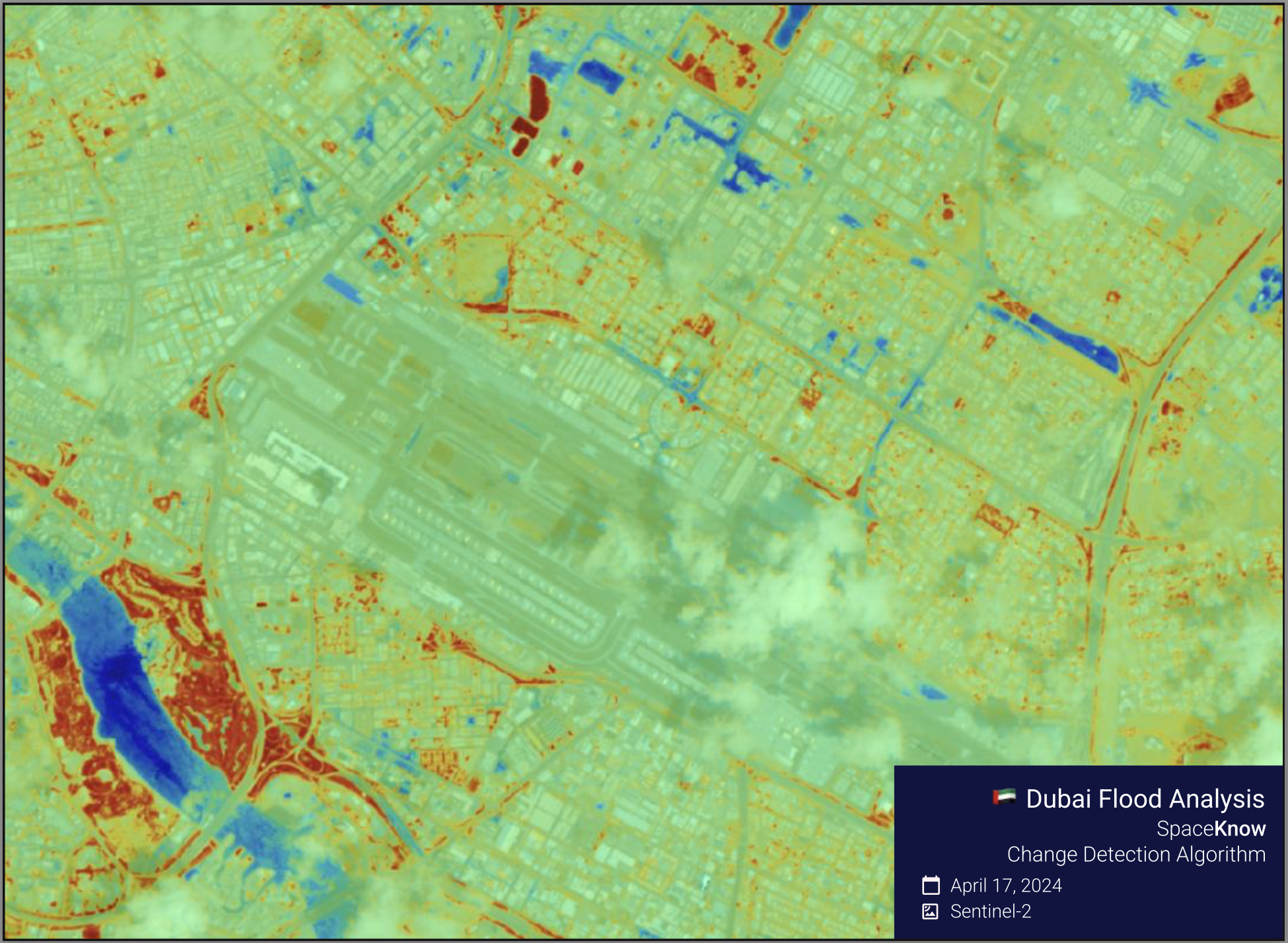
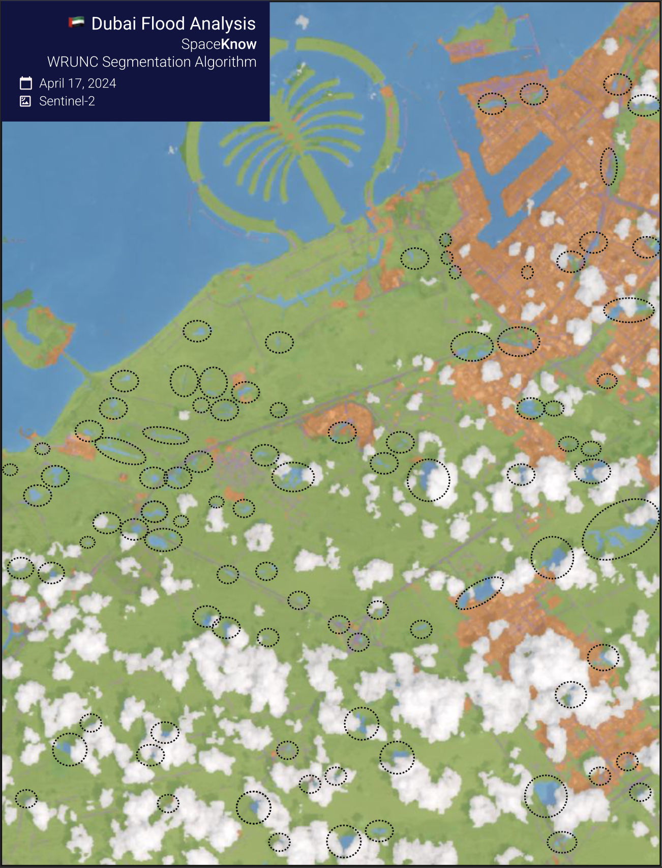
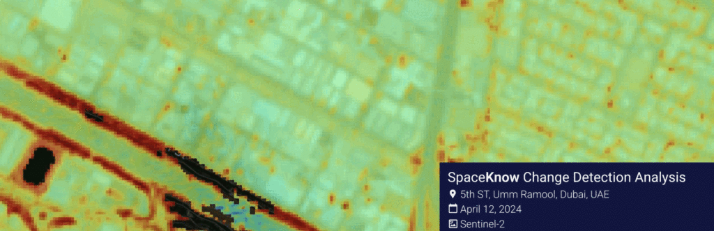
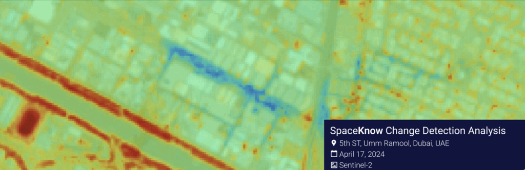
To quickly detect newly created bodies of water in Dubai, our analysts applied the internally developed change detection algorithm and land classification algorithm (which can efficiently and accurately classify water bodies, roads, urban areas, non-urban areas, and clouds on a low-resolution image) over the area of 184 km2 (see Figures 1 and 2).
The change detection algorithm immediately drew our attention to a substantial change in the road near Nad Shamma Park which experienced a massive flood on the 5th ST, Umm Ramool, and surrounding streets (see Figure 3a & 3b).
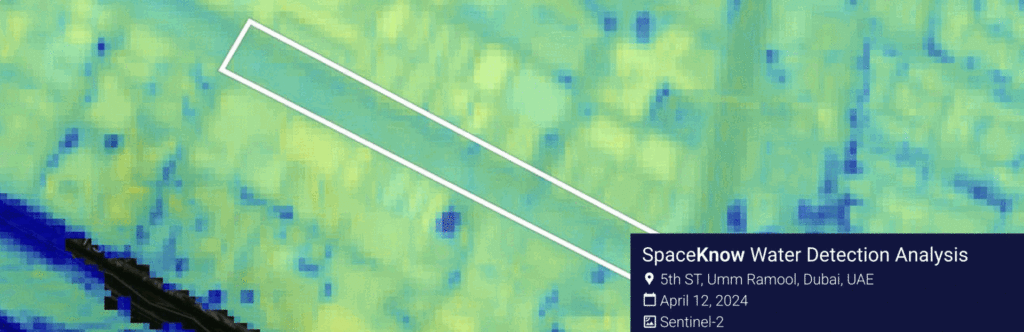
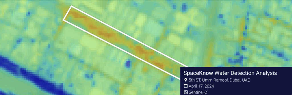
The presence of water on 5th Street, Umm Ramool, Dubai, UAE, has been further validated by the water detection algorithm (see Figure 4a & 4b)
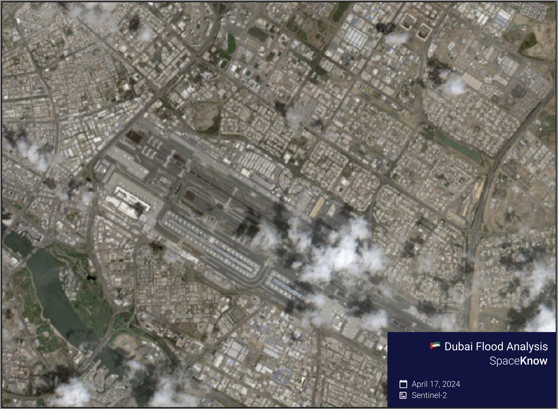
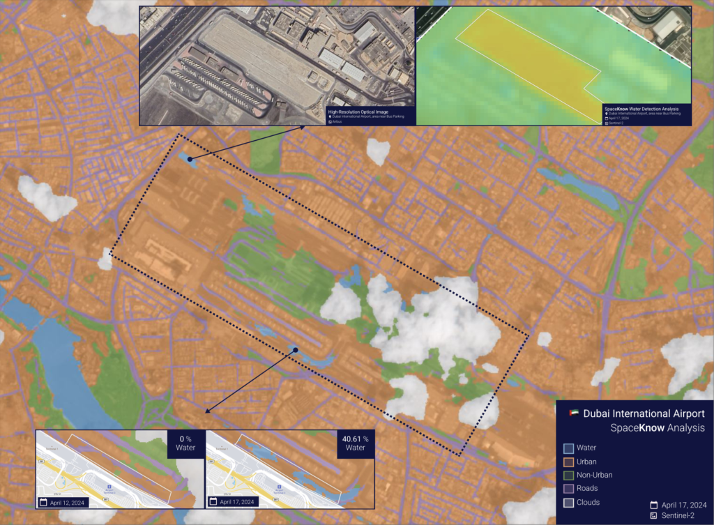
Dubai International Airport, one of the world’s busiest airports and a crucial hub for travel across the Middle East, was another heavily affected area, grappling with a backlog of flights for three days following the storm. According to the land classification algorithm, water was present on the runway and also around Terminals (see Figure 5).
In this blog, we briefly showcased two SpaceKnow AI algorithms focused on change and water detection tailored to cost-efficient scans over large areas. SpaceKnow boasts numerous distinctive detection algorithms capable of efficient and automatic analysis and categorization of satellite images across various resolutions. We take pride in assisting our clients and the public in acquiring valuable insights from areas impacted by natural disasters, whether it be floods, wildfires, or landslides, all from a safe distance and on scale.
Do you have a particular scenario where you believe satellite imagery could be beneficial? Feel free to reach out, and we’ll gladly provide guidance on how satellite analysis can help your needs.