On July 25th 2020, a ship called MV Wakashio ran aground off Pointe d’Esny, south of Mauritius, and began to spill at least 1,000 tons of oil into the Indian Ocean, endangering world-renowned coral reefs and lagoons. This has been called the biggest ecological disaster ever faced in the Indian Ocean.
We ran some of our change detection algorithms over the area.
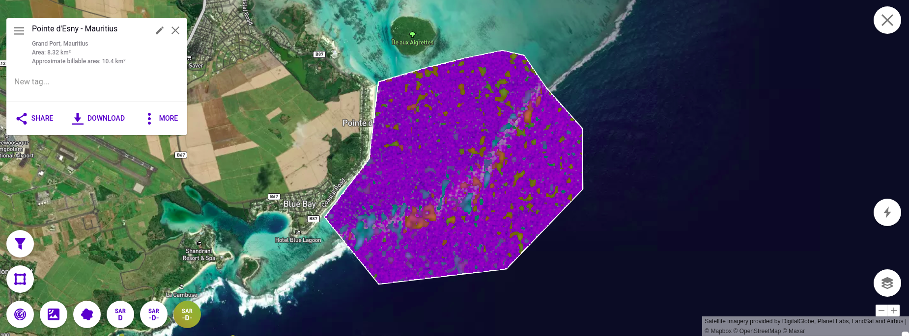
The satellite data we used for these analyses are from synthetic aperture radar (SAR). SAR penetrates through clouds and therefore gives us a consistent view of the area across time, regardless of the weather. These images come to us from the Sentinel-1A satellite of the European Space Agency (ESA). This satellite typically flies over any given area of interest in the world once every 6-12 days (called a revisit rate). For this particular location, Sentinel-1A has a 12-day revisit rate.
On July 17th, before the MV Wakashio appeared, we saw the normal pattern of waves crashing on the coral reef.
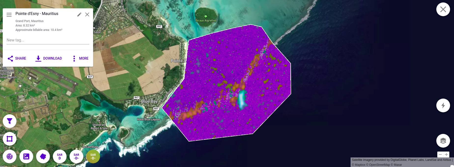
Fast-forward 12 days to July 29th and we saw the MV Wakashio run aground on the reef, highlighted in bright blue by our algorithm. However, the oil had not begun to leak yet.
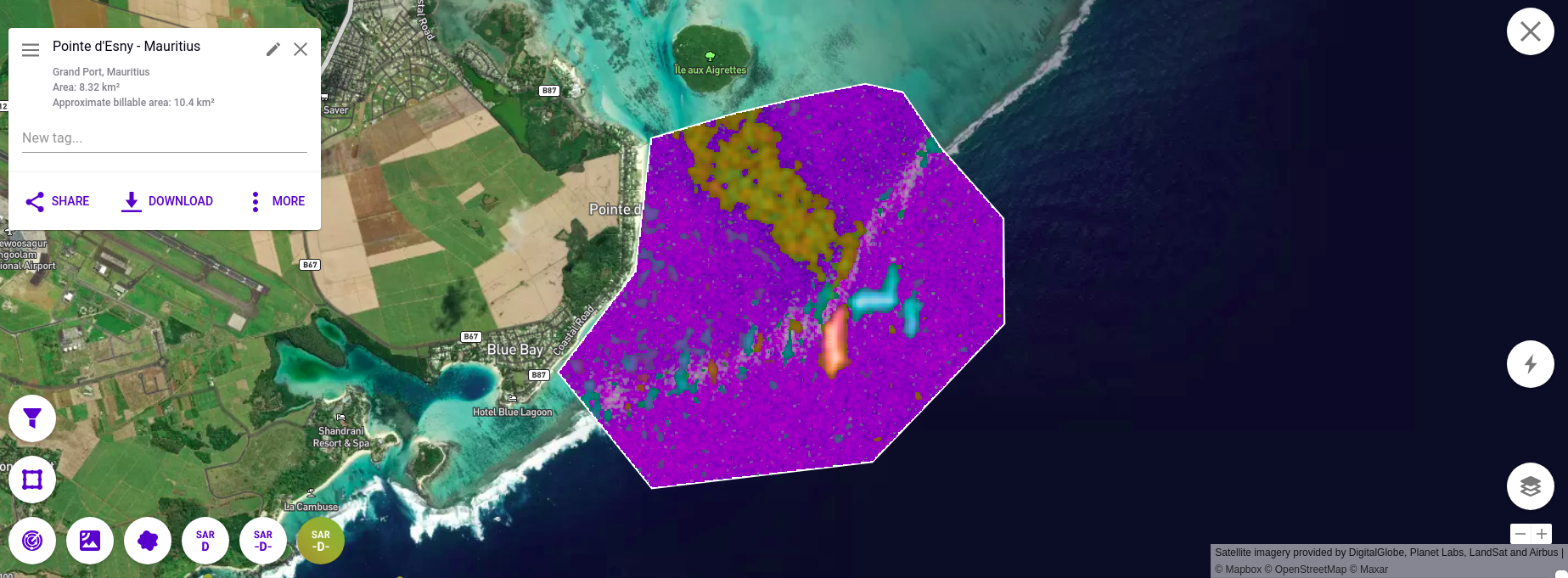
12 days later, on August 10th, we see the addition of the fire fighting vessel, Boka Expedition, and the French military vessel, FNS Champlain, both also highlighted in bright blue. More importantly, we see the deluge of oil leaking from the MV Wakashio highlighted in greenish-brown.
SAR change detection has many applications. The data and algorithms used for these analyses are the same ones we use to construct the indices in SpaceKnow Nowcasting Solutions – near real-time independent indicators of overall manufacturing activity in countries around the world. For more information on our capabilities with SAR data, our indices, or our company, please visit spaceknow.com, or contact us at info@spaceknow.com.