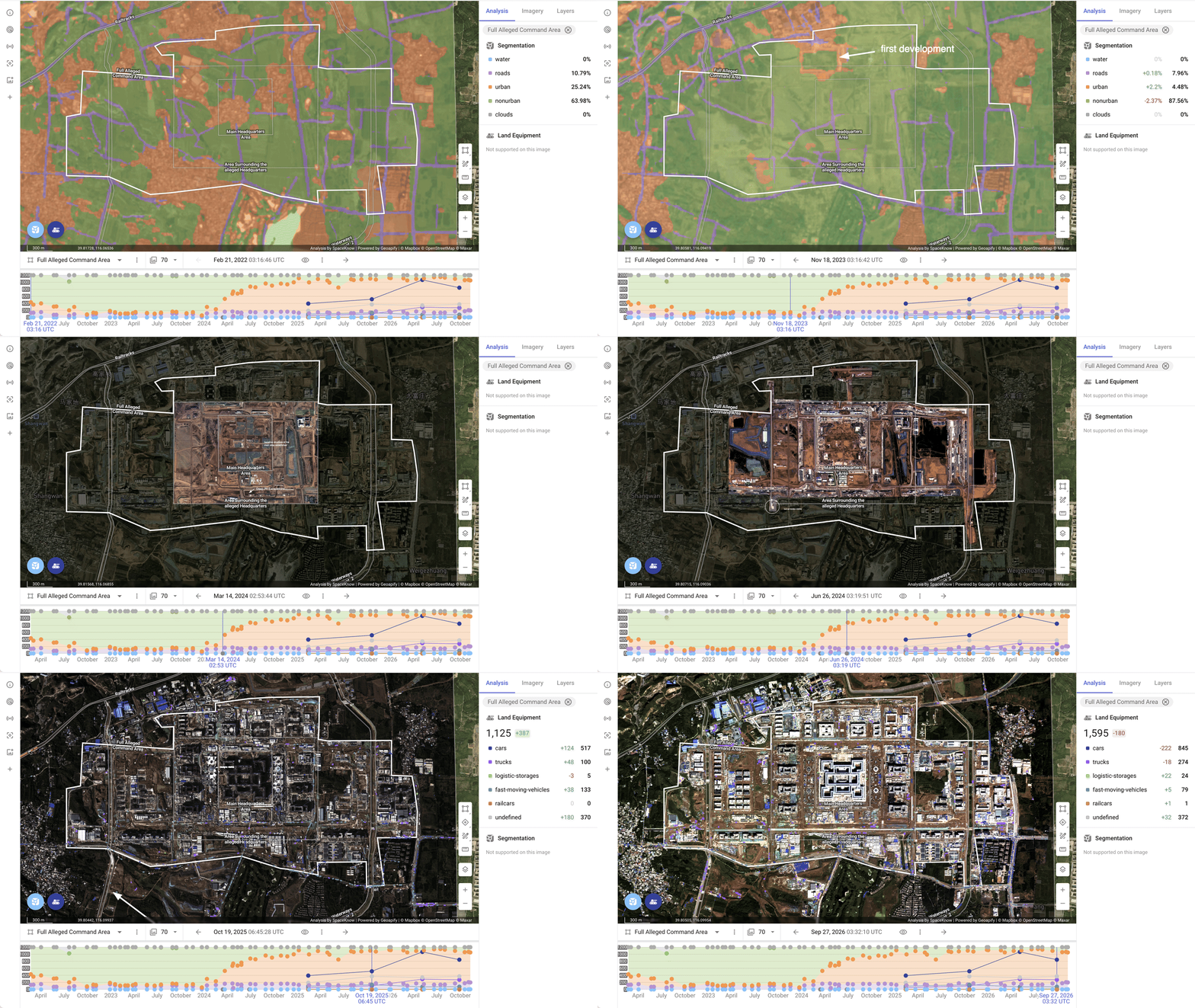
This satellite time-series analysis tracks the four-year construction of a sprawling, fortified facility in southwest Beijing, alleged by Western defense analysts to be a massive wartime military command center. While Beijing has made no public statements regarding the site’s purpose, combining monthly 10-meter Sentinel-2 imagery with sub-meter high-resolution captures reveals the complete transformation of rural villages into a multi-square-kilometer megacomplex. What makes this analysis particularly compelling is how it exposes the subterranean engineering phase – capturing deep open-pit excavations and wide-radius tunnel portals before they were backfilled and concealed beneath surface roads. Even on low-resolution imagery, our automated segmentation algorithm isolates the construction timeline, from initial village clearing in late 2022 to a full-scale construction.