Spaceknow presents large scale 3D surface mapping and monitoring using low and high resolution satellite radar imaging. Leveraging the latest SAR interferometry technology and access to high resolution satellite imagery from multiple providers, we are able to create precise digital elevation models and surface displacement maps anywhere on Earth. An example of an application benefiting from these advanced observation methods is the mining industry.
Surface mining activities cause major changes to land cover and land use of the mining area. Large volumes of waste material are excavated, causing continuous change in topography. Minimising footprints of mining and shift of the whole industry towards sustainable mining are key drivers of advanced mine monitoring. Regular long-term observations of the surface and facilities located in the mining area are necessary to ensure safety of mining operations, and minimise negative impacts on the environment.

Radar satellite imaging is an efficient and cost effective tool for frequent large scale observation of mining areas. Modern SAR (synthetic aperture radar) satellites (Sentinel 1 and Iceye) achieve high spatial resolution imagery and geolocation precision (GSD i.e. ground sampling distance is ranging from tens of metres to tens of centimeters). SAR satellite antenna emits radar waves to the Earth surface. Radar reflection is recorded and forms a 2D image of the surface. Unlike optical satellites, SAR operates independently of natural light and penetrates through clouds. In comparison to labour intensive conventional techniques used for in situ mine monitoring, SAR imaging quickly maps large areas including hazardous and remote locations with ease.
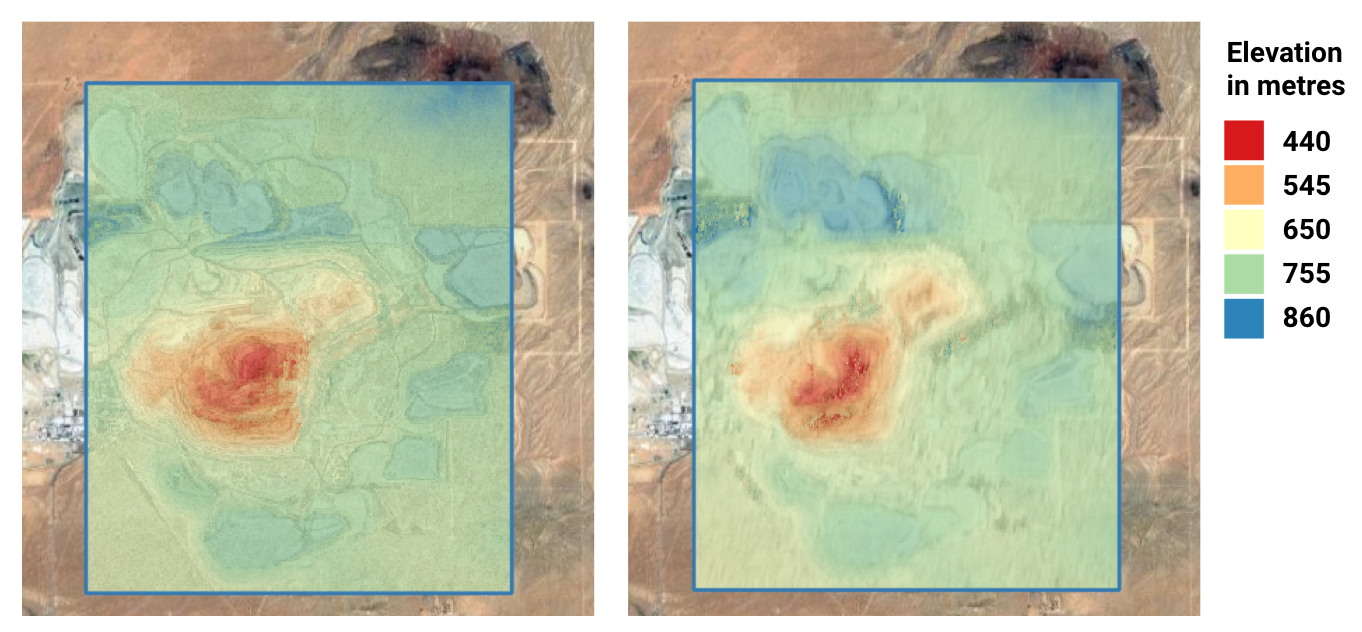
Combining multiple SAR satellite images of the same area of interest acquired at slightly different view points allows us to use interferometry techniques to precisely measure surface displacement and create 3D models of the surface. Relative surface displacement in the line-of-sight (LOS) direction from the radar antenna to the surface can be measured with centimetre accuracy. Measurement of absolute height in 3D models achieves vertical accuracy in the order of metres.
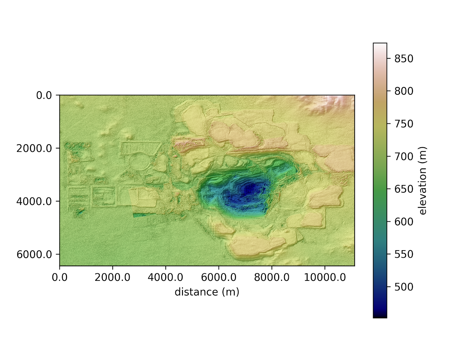
Figures 1, 2, and 3 show an example of elevation and displacement measurements in an open pit mine. Analysis of these measurements allows us to estimate an approximate amount of soil excavated over the observation period. Time series of surface displacement measurements can be further used for monitoring of ground level subsidence in the mining area. Frequent monitoring of subsidence helps to avoid hazards of landslides. Land subsidence should be carefully monitored especially if the mining activity takes place a few kilometers from the nearby residential area or important infrastructure which could be seriously damaged by sudden landslides.
3D surface mapping and monitoring using SAR technology can be used for a variety of purposes for mine operators, investment professionals and risk monitoring experts. We can survey remote lands for mining, provide data for exploration planning, track changes over time and provide information on environmental issues that may impact your business. We can track production, capacity and inventory changes in mines.
Interested in learning more? Reach out to us at info@spaceknow.com or get in touch via www.spaceknow.com.
Written by Tomas Lukes on behalf of SpaceKnow.